
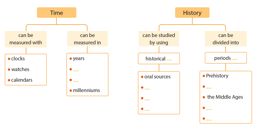
TIME AND HISTORY
Everything we do can be measured in time. It takes a certain amount of time to get out of bed in the morning, to get to school and to do our homework. History is also measured in time. It is the study of the past. It is important to learn about the past because it can help us to make the future better.
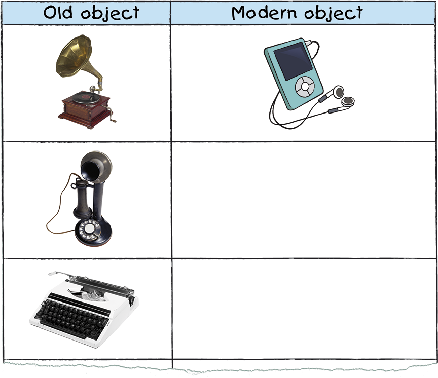
- Look at the old objects in the left-hand column. Draw their modern equivalents in your notebook or find photos.
- Make your own chart in your notebook. Find photos of old objects and their modern equivalents.
- Think about what the objects you have chosen will look like in the future. Draw pictures in your notebook and label them.
Time is constantly moving forward. It never stops. We can talk about time in the past present or future.
History is the study of the past. People who study history are called historians. They study historical sources to find out information about the past.
History is the study of the past. People who study history are called historians. They study historical sources to find out information about the past.
 |
Oral sources are things from the past that are told from person to person.
|
Physical sources are objects that give us information about the past. These objects can be as big as a castle or as small as a simple tool.
 |
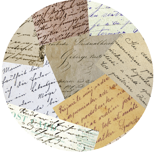
Written sources include books, letters, newspapers and other written documents from the past.
 |
Visual sources can be paintings, drawings, or photographs that show life in the past.
The history of human beings is very long. We use different measurements of time to organise information about the past.
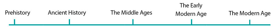
We use a timeline to show important events in the order they happened. They usually show us what happened during centuries or even millenniums. We can divide the past into five main periods of history:
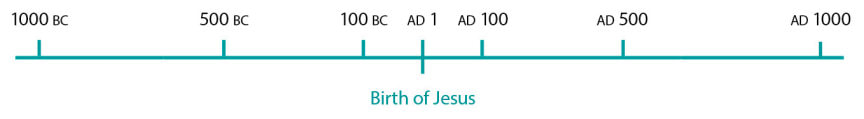
The time before the birth of Jesus Christ is called BC. The time after the birth of Jesus Christ is called AD.
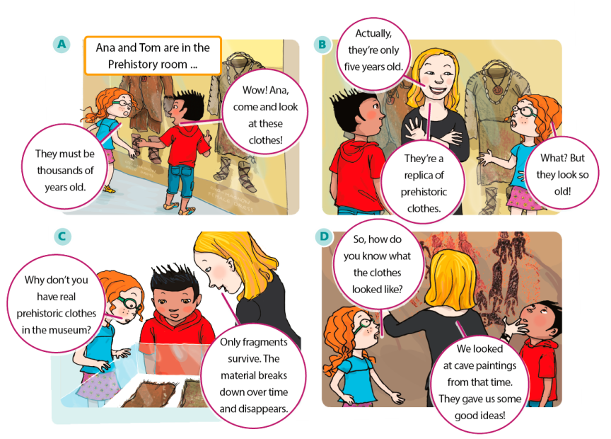
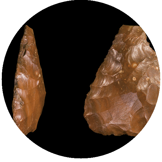
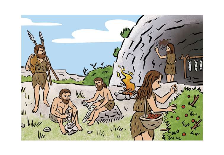
Prehistory is the period from when the first humans existed, about two million years ago, to when written history began. The people that lived during this period didn’t know how to write, but they left historical sources called artefacts. There were two main periods in Prehistory: the Palaeolithic Periodand the Neolithic Period.
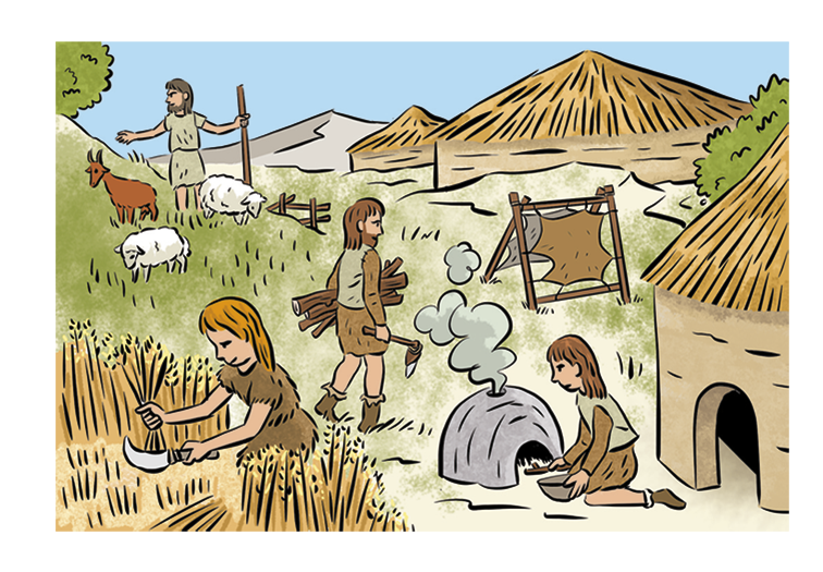
PREHISTORY
Prehistory is the period from when the first humans existed, about two million years ago, to when written history began. The people that lived during this period didn’t know how to write, but they left historical sources called artefacts. There were two main periods in Prehistory: the Palaeolithic Periodand the Neolithic Period.
In the Neolithic Period, people started to live in one place and form communities. They started to grow crops and keep domestic animals. They used stone and metal to make more complex tools.
ANCIENT HISTORY
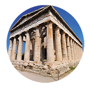
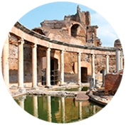
Ancient History is the period from when written history began to the fall of the Roman Empire. During this time, great civilisations developed in countries such as Greece, Egypt, China and Mexico.
Each civilisation developed a different way of writing. For example Ancient Egyptians wrote in hieroglyphics and the Romans wrote in Latin.People began to live in big towns and cities, such as Rome and Athens. They also built public and Greek temple private buildings.
They formed governments, wrote laws, developed skills and had jobs. They also made important advances in agriculture.
 |  |
THE MIDDLE AGES
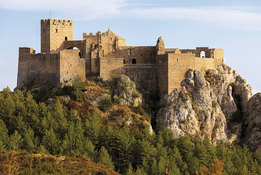
People built castles and walls to defend their territory.

In Christian areas, churches and cathedrals were built. Burgos Cathedral is one of Spain’s most beautiful cathedrals... if not the MOST!
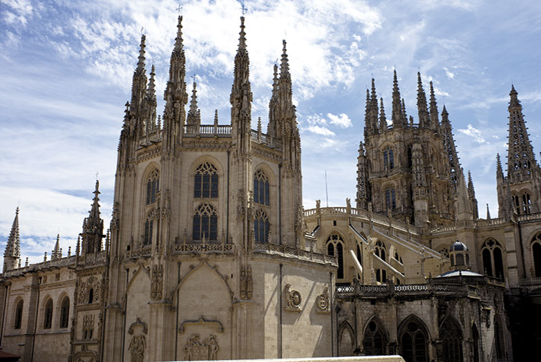
The Burgos Cathedral building process began in 1221 and it was completed in 1567.

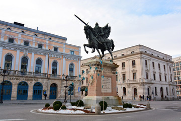
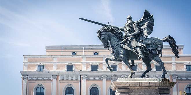
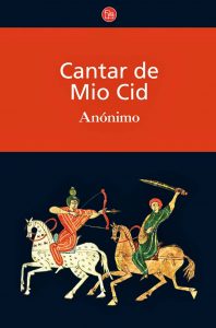
Do you know anything about "El Cid Campeador"?
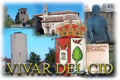
He was a very important Spanish knight and hero. Rodrigo Díaz de Vivar was born in Vivar (Burgos) in 1045. He died in Valencia in July 1099.
El Cantar de mio Cid, literally "The Song of my Cid" (or El Poema de mio Cid), is the oldest preserved Castilian epic poem. Based on a true story, it tells of the Castilian hero El Cid, and takes place during the Reconquista, or reconquest of Spain from the Moors.
In Islamic areas, mosques were built.
In 1492 Christian kingdoms in northern Spain conquered the Muslims and spread the Catholic religion.
In 1492 Christian kingdoms in northern Spain conquered the Muslims and spread the Catholic religion.
   
THE MODERN AGE
 The Early Modern Age began about five hundred years ago. Small kingdoms came together to form big countries with one king. The Early Modern Age began about five hundred years ago. Small kingdoms came together to form big countries with one king.The Modern Age began about 200 years ago. It was a time of industry and changes in society. New inventions, such as the steam engine, changed the way people lived and worked. Cities grew and changed, with new streets and buildings. Public services, such as schools, hospitals and transport, became common. With the invention of the telephone, radio and television, communication became easier. |
Factories made mass-produced products. People moved to towns and cities to work in these factories, so urban populations increased.
CONTEMPORARY HISTORY
More than 500,000 people died in the Spanish Civil War of the 1930s.The victorious Gen. Francisco Franco ruled as a brutal dictator until his death in 1975.

Why is history so important for us?
'Those who do not learn history are doomed to repeat it.'
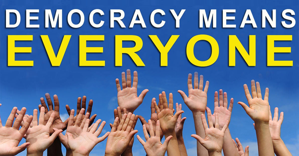
Soon after, Spain began to transform itself into a modern, industrial, and democratic European nation.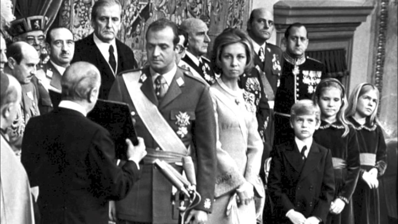
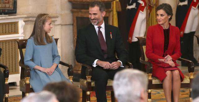

The word democracy describes a form of government. In a democracy the people have a say in how the government is run. They do this by voting. Democracies are different from dictatorships. In a dictatorship one person called a dictator makes all the rules.
SPAIN
Landscapes have both natural and man-made features. Natural features have not been changed by people, for example, mountains. Man-made features were put there by people, for example, roads. There are many different natural and man-made features in Spain. Can you name any?

Activity: Read the descriptions below and match them to the pictures.
- Cars and other vehicles travel on this.
- This is an area of land that is surrounded by water.
- This is a high wall of rock next to the sea.
- These can be used as homes for people or as offices.
- This is an area of sand or rocks next to the sea.
- Ana and Tom’s school trip project
- Look at Ana and Tom’s project, then answer the questions.

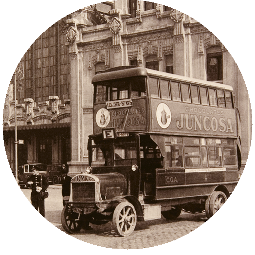
Look at the old photograph. When do you think it was taken?
Now, look at the picture on pages 56 and 57 of this unit. Compare it with the picture on this page. How has the town changed?
Some man-made features can damage natural landscapes. Think of some ways humans have a positive impact on landscapes.
Mainland Spain is located in the south-west of Europe. Spain is divided into areas of land called autonomous communities. There are seventeen autonomous communities in Spain. Spain also has two autonomous cities in the north of Africa - Ceuta and Melilla. The autonomous communities have their own government and most of them have a capital city.
 This physical map shows where the important landforms in Spain and the Iberian Peninsula are located. Hills, mountains and low areas of lands are in different colours so it’s easy for us to see them. There is also a key which tells us what each colour means.
Most of Spain is located on the Iberian Peninsula. A peninsula is an area of land that is mostly surrounded by water, but is connected to a larger area of land on one side. There are lots of different types of landscapes in Spain and many different types of landforms.
The Cordillera Cantábrica, the Pyrenees, the Sistema Ibérico, the Sistema Central, the Sierra Morena and the Cordillera Bética are the main mountain ranges in Spain.
Thousands of rivers flow across the Iberian Peninsula but most of them are quite small and dry up during the summer months. Some of Spain’s largest rivers travel hundreds of kilometres through many villages, towns and cities. These rivers are used for agriculture, such as growing fruit and vegetables. They also provide drinking water to both wild animals and humans.

The major rivers begin high in the summits of the mountain ranges of Spain. Each river begins at a different source and travels across Spain to its mouth, located in one of the major bodies of water surrounding the Iberian Peninsula.
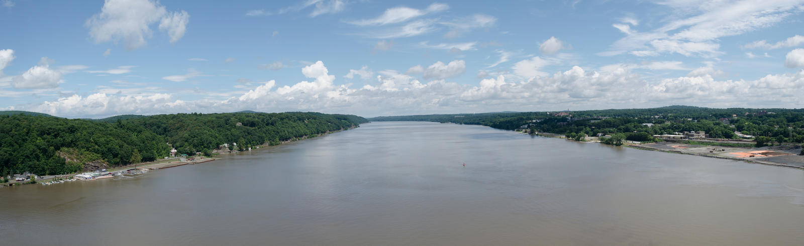
The Tajo is the longest and one of the most important rivers in the Iberian Peninsula. Many man-made dams and reservoirs along the Tajo provide fresh drinking water for central Spain and Portugal. The Tajo passes through many important towns and cities in Spain including Aranjuez, Toledo, Talavera de la Reina and Lisbon in Portugal.

- Work with a partner and make a list of things we can do to help protect the environment.
- Find out about an environmental group in your area. What does the group do? How can you get involved?
- In groups, plan a clean-up event for your school or local area. Choose a place that needs your help. Make posters to encourage others to participate.
ART PROJECT
Make a three-dimensional physical map with different landforms.
- Brown, yellow and green plasticine
- Wooden sticks
- Cardboard
- Pieces of paper

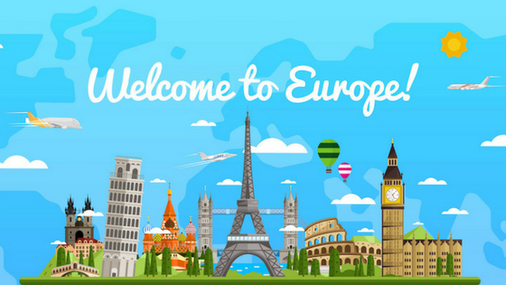
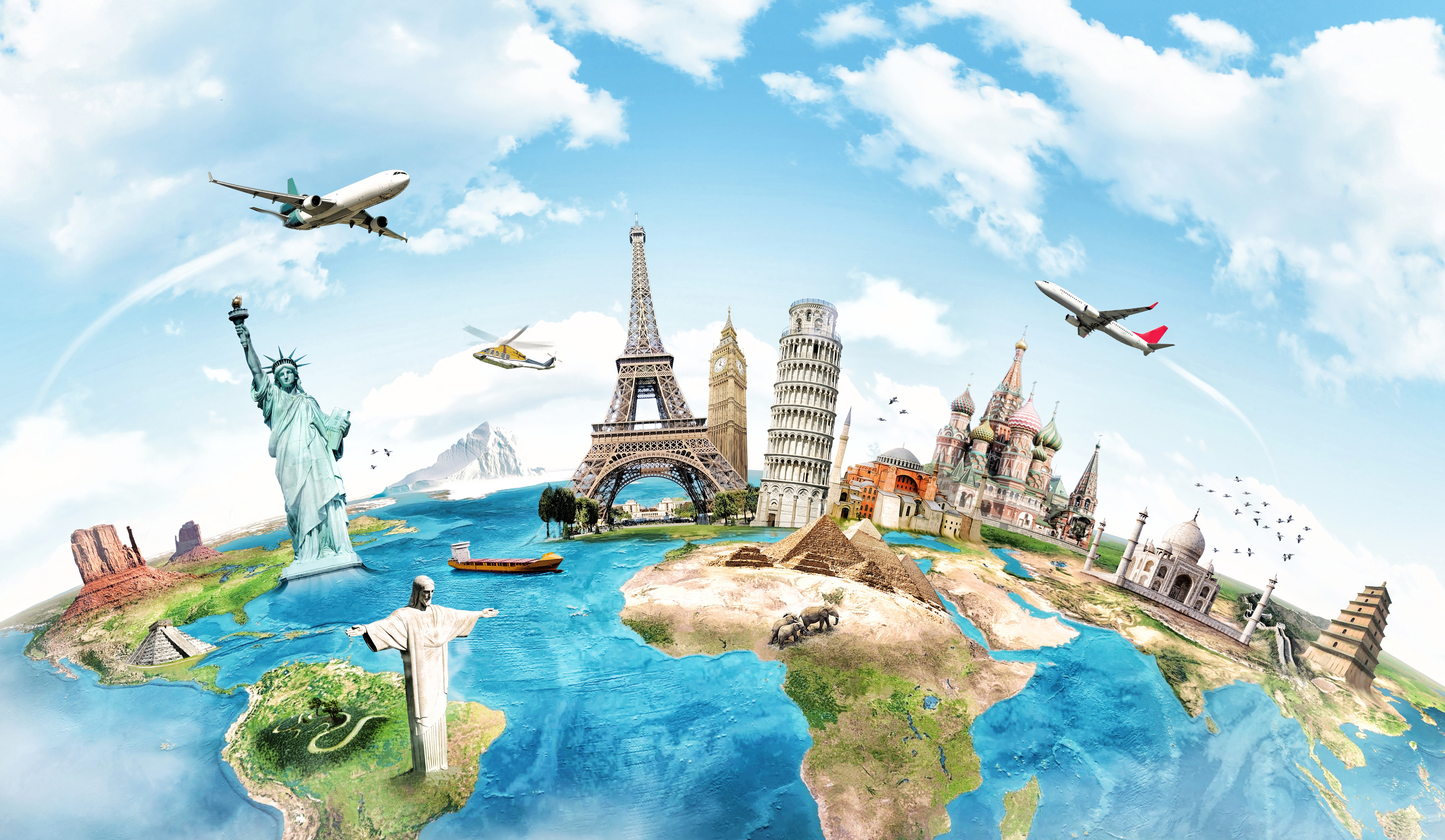
EUROPE
POWER POINT PRESENTATIONS:
Europe is a wealthy continent and is the center of the West and Western Democracy.
There are 50 countries in Europe with a total of more than 742 million people living on the continent. About 11% of the world's population lives in Europe.

Most languages belong to either the Romance languages (such as French, Italian, Spanish), the Germanic languages (among them are German or English) and the Slavic languages (among them Russian, Bulgarian, Polish).

28 of the European countries belong to the European Union.


The Alps are the highest mountain range in Europe.
The Atlantic Ocean separates Europe from North and South America.

- Big Ben in London (England)

- Eiffel Tower in Paris (France)

- Neuschwanstein Castle in Bavaria (Germany)

- Alhambra in Granada (Spain)

- Atomium in Brussels (Belgium)

- Kremlin in Moscow (Russia)

- Acropolis in Athens (Greece)

- Mont Blanc in Switzerland

- Colosseo in Rome (Italy)

Have you ever been to any of these places?


1. What is the difference between Europe and European Union?
2. What is the largest country in Europe?

3. What is the smallest country in Europe? Where is it located?

4. Name three European countries which are located on islands.
5. Which countries make up Scandinavia?
6. Which country is to the west of Spain?
7. Which four countries border Switzerland?
8. Budapest is the capital city of which country?

9. Which country is bordered by Norway, Sweden and Russia?
10. Find out what the most common languages in Europe are.

11. Find out why the Caspian Sea is called a sea, if it is actually a lake.
12. Where is the mouth of the Rhine located?
13. Many people have successfully swam across the English Channel. Find out who did it in the quickest time. How long did it take?

14. The Alps are a popular tourist destination all year long. Find out what type of activities people can do there.

15. What is a peninsula?

16. Which river is part of the border between Germany and France?
17. Which sea forms a natural border between Europe and Asia?
Make a poster or a Power Point Presentation about a European country (it's possible to make it in couples).
- Write its name at the top of the poster.
- Draw and colour its flag.
- Find a physical map that shows the major physical features. Stick it on the poster.
- Stick some photos of important traditions, monuments or landscapes.
- Explain some meaningful facts about this country.
Get ready to talk about it!
Group A- B (Check your class number and look for your country in the list below!).
- Russia
- France
- Spain
- Sweden
- Norway
- Germany
- Finland
- Poland
- Italy
- United Kingdom
- Romania
- Belarus
- Greece
- Bulgaria
- Iceland
- Hungary
- Portugal
- Austria
- Czech Republic
- Ireland
- Denmark
- Switzerland
- Netherlands
- Belgium
UNIT 2: AROUND THE WORLD
SOCIAL SCIENCE EXAM (WEDNESDAY, 29th NOV. 2017):
- Continents.
- Countries and capital cities.
- Mountains and rivers.

CONTINENTS AND OCEANS (I recommend you to listen to the song, it's full of content!).
Continents are like big pieces of land. There are seven continents on Earth. The continents are called:
- Africa
- Antarctica
Antarctica is a continent that doesn’t have any countries. It is one of the coldest places in the world. People don’t live here.
- Asia
- Australia
- Europe
Europe is home to the smallest country in the world, the Holy See or the Vatican. It is the smallest country both in size and population.
- North America
- South America
Most of the continents have lots of different countries on them. A country is also a piece of land. But countries are much smaller than continents. Each country has its own government. The government makes the rules that everyone has to follow.

The five oceans are called:
- The Pacific Ocean
- The Atlantic Ocean
- The Indian Ocean
- Arctic Ocean
- Southern Ocean
Seas are smaller than oceans and are usually located where the land and ocean meet. Typically, seas are partially enclosed by land.
COUNTRIES AROUND THE WORLD
Do you know the name of your country? All countries have something called a government. Governments makes rules called laws. People have to follow the laws. You probably have rules in your house. What are some rules you have to follow in your home?
Each country has a capital city. The leader of the country usually lives in the capital city. This is also where the members of the government meet to make laws. What is the name of the capital city in your country?
COUNTRIES AND CAPITAL CITIES TO STUDY FOR THE EXAM (It's essential to learn their location).
- Spain - Madrid
- France - Paris
- Germany - Berlin
- Italy - Rome
- Ireland - Dublin
- United Kingdom - London
- India - New Delhi
- Australia - Canberra
- New Zealand - Wellington
- South Africa - Cape Town
- United States - Washington D.C.
- Canada - Ottawa
- Russia - Moscow
- China - Beijing
- Morocco - Rabat
- Brazil - Brasilia

It's time to practise!
Continents and oceans:
European countries:
Worldwide countries:

MOUNTAINS

A mountain is a landform that rises high above the surrounding terrain in a limited area. They are made from rocks and earth.
Generally, mountains are higher than 600 metres. Those less than 600 metres are called hills.
Some common features of mountains include the following:
- the summit, or the top of a mountain;
- the slope, or side of the mountain; and
- a very steep valley between young mountains.

A plateau is a raised area of land that is flat on top, sometimes found in mountainous areas.
RIVERS

All rivers start at the highest point in an area. As the river flows downstream, it gains more water from other streams, rivers, springs, added rainfall, and other water sources.
A tributary or affluent is a stream or river that flows into a larger stream. A tributary does not flow directly into a sea or ocean.
A tributary or affluent is a stream or river that flows into a larger stream. A tributary does not flow directly into a sea or ocean.
A river is freshwater flowing across the surface of the land, usually to the sea.
- The longest river in the world is the Nile River, it reaches around 6650 kilometers in length (4132 miles).
- The second longest river in the world is the Amazon River, it reaches around 6400 kilometres in length (4000 miles).
 for the exam
 Check where these oceans and seas are located:
 - Indian Ocean
- Caribbean Sea
- Southern Ocean
Do you know the country where the Effeil tower is? Is it China...? May it be Portugal...?
Is Portugal to the East of Spain? Or... may it be to the West?
How many continents are there in the world? Five? Six? Eight?
Are pyramids common in Austria? Or may they be more common in Egypt?
Do not forget to study where the 16 countries of the list are located!
...and these are all my recommendations...

1. Why do you think Antartica is called the frozen continent?
Ismael: Because it is very cold and it is surrounded by ice .
Xavier: Because it's so cold.
África: The Antartica is called the frozen continent because it is cold and there is to much ice.

2. How does it change from summer to winter?
África: In summer the Antartica changes because ice melts.
Rodrigo: Antartica changes a lot during the summer since in the southern hemisphere (our winter) the ice sheet decreases in size.

3. Choose one continent or ocean and write below the animals that live there.
Elia: In Africa there are jungles and a lot of wild animals, lions and tigers.
Ismael: In Antártica live penguins and the polar bears.
Xavier: Polar Bear and seals

4. Why do you think few plants and animals can live at the summit of very high mountains?
5. What happens to the fresh water of a river when it mixes with the salt water of the ocean?
In which contient is the widest river in the world? What can you say about this river?
Iván: I think the widest in the world is Amazon river.It crosses Brazil in South America.

6. Did you know that there are underwater mountains? Find out where the largest underwater mountain is located.

7. Why do you think it is important to protect local monuments?
UNIT 1: MAPS

PHYSICAL MAP
- Rivers
- Mountains
- Lakes

POLITICAL MAP
- Countries
- Autonomous Communities
- Cities

STREET MAP
- Streets
- Squares
- Parks
- Roundabouts
Can you guess the city that this map represents?

CERCANIAS' MAP

FLOOR PLAN

ReplyDelete1.Are 7 continents in Earth.
2. In Egipt
ReplyDeleteYes are 7 continent
ReplyDeleteMaria.
1 Because is very cold and are lot of ice
ReplyDelete